
Gratwandern
Marco Contino & Martin Verdross
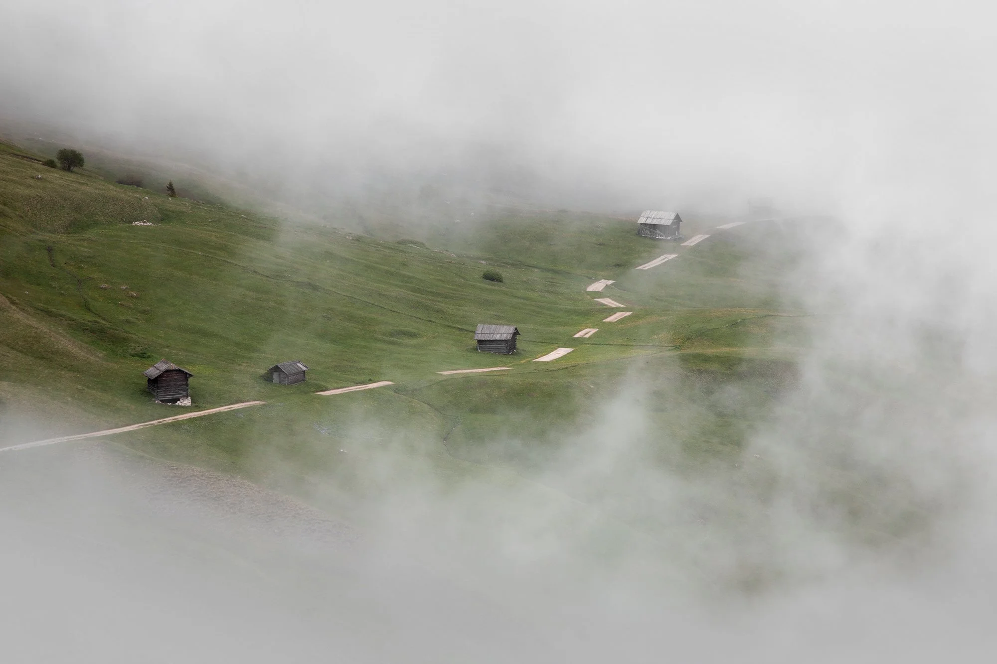
The work of Marco Contino and Martin Verdross "gratwandern", (very close to the expression to be in an ambiguous situation) engages itself in a very explicit way with the theme of the border. The Landart installation consists in laying, with a constant interval, rectangular grass lobes on a white dolomite gravel road. The road, a highly visible human intervention on the landscape is partly camouflaged, but as a result we can see the typical broken line, which is used in cartography to symbolise borders.

Exhibit place Pra de Pütia
The "Prà de Pütia", which sit to the north of Sas de Pütia, offer magnificent views of gorgeous natural landscapes. These meadows are used for both grazing and haymaking and also make an ideal place for a short walk or full-day hike. These areas are wonderful to visit the whole year through. “Roa dl Maier” is called the place between Börz and Sespütia, from where you can admire some of the most beautiful and important geological formations of the Dolomites.


